The Ultimate Road Trip: Driving the Foothills Parkway
Would you like to save this full guide?
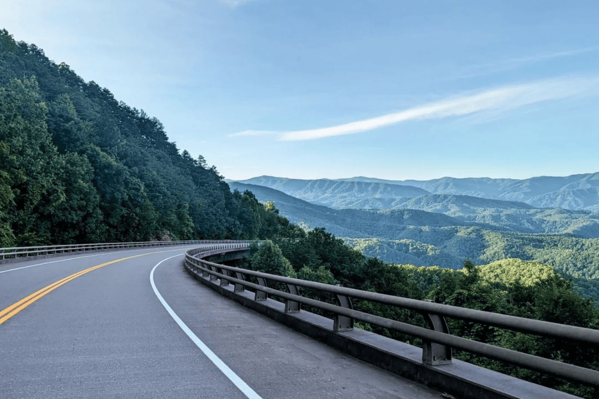
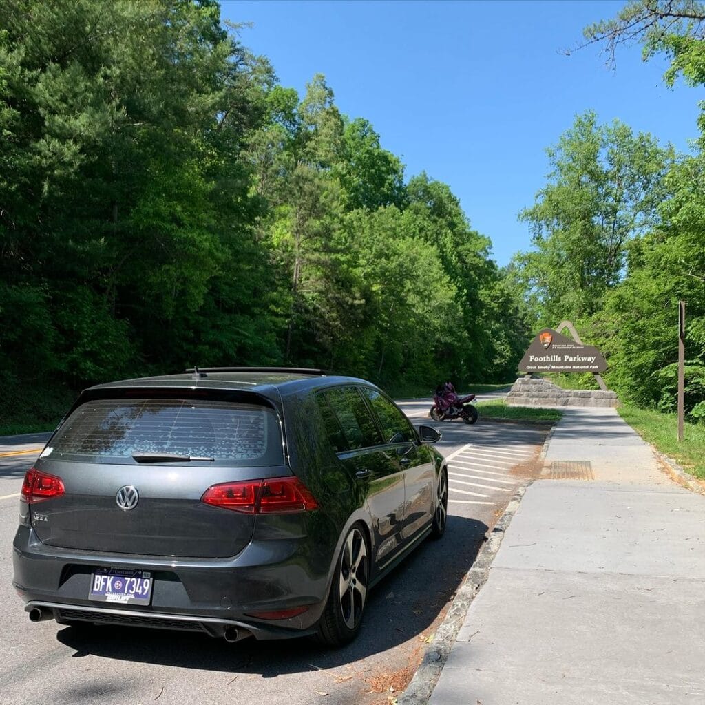
The Foothills Parkway skirts the edge of Great Smoky Mountains National Park on the Tennessee side, creating one of the most beautiful scenic drives in the Smokies.
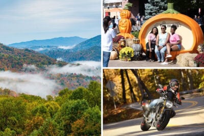
Drivers meander through the beauty of Tennessee, whether during peak spring wildflower season or when the cascade of colors falls over the mountains in fall.
It’s a roadway so stunning that even though it’s not completed, it still ranks as one of the top things to do in Eastern Tennessee. The Foothills Parkway offers a drive without traffic or crowds, which is not an easy feat for a road surrounding America’s most visited national park.
The leisurely drive travelers enjoy today wasn’t without hard work, political wrangling, and disaster dodging. Buckle up; there’s a lot to unpack for a trip to the Foothills Parkway of Great Smoky Mountains National Park.
What Is the Foothills Parkway?
The Foothills Parkway, in concept, is a 72-mile congressionally approved parkway, offering an exceptional driving and access experience around the northern half of Great Smoky Mountains National Park.
Plans call for a route that runs from I-40 in Cosby all the way to U.S. Route 129 in Chilhowee. The layout largely runs the border of the park, but only on the Tennessee side. That’s intentional – and we’ll get to that in a bit.
The Foothills Parkway approval hinged on three benefits:
- A causal driving experience on a limited-access road showcasing the landscape while preserving and protecting the environment.
- Allow better access to all areas of the park that aren’t easily accessible from Newfound Gap or secondary park roads.
- Relieve traffic in the busy Sevierville/Pigeon Forge/Gatlinburg corridor while connecting with other highways or interstates at the respective terminus points of the parkway.
Parkways differ from highways or interstates, with protected right-of-ways showcasing natural settings instead of commercialism. Only the Gatlinburg Spur allows businesses along the route. Even commercial traffic isn’t allowed on the road.
Limited access points provide longer stretches of scenic, unimpeded driving. When all is said and done, the Foothills Parkway will have seven access points across 72 miles.
NOTE: The Foothills Parkway is separate from the Great Smoky Mountains Byway. The latter runs from just south of Knoxville, past Johnson City, to the North Carolina state line.
It’s also a different road than “The Parkway” of Gatlinburg and Pigeon Forge, which is the main thoroughfare.

How Much of the Foothills Parkway Is Complete in 2025?
When the Foothills Parkway was approved in February 1944, nobody could’ve imagined it would be written about today as barely halfway done.
As of mid-2024, 33 miles on the western edge of the Parkway from Chilhowee to Wears Valley are open and have been since 2018. Work for a 6-mile stretch between I-40 and Cosby finished in 1968. Together, only a total of 39 miles – with a big gap in the middle – are complete.
The 33-mile chunk that remains incomplete runs from Wears Valley through the Gatlinburg Spur to Cosby. When I say incomplete – the National Park Service secured the right-of-way on the land, but that’s about it.
You might read references to The Missing Link of the Foothills Parkway. That is not this main unbuilt section, but there’s a great story to go along with it – stay tuned!
How is that possible? Congress can authorize a National Park Service site without funding it. In fact, it’s the annual budget appropriations that provide funding. Wars, economic struggles, and a litany of factors can impact funding.
The Foothills Parkway is generally referred to as Foothills Parkway East and Foothills Parkway West because of the gap between the completed sections.
Even more interesting, this route is Tennessee’s oldest unfinished highway project and the only Congressionally Mandated Parkway to remain incomplete.
How Long Does It Take to Drive Foothills Parkway?
As noted above, the Foothills Parkway isn’t a traditional highway or interstate. It’s managed by the National Park Service, and the speed limits match those of other park roads.
That said, the speed limit on Foothills Parkway stays a constant 35 miles per hour. With the longest parkway stretch spanning 33 miles, that’s about an hour of drive time without stopping – oh, but you’ll want to stop and see the views!
Don’t assume only the bears and birds are watching you drive by. Tennessee Highway Patrol monitors this area for speeding, reckless driving, and driving under the influence, among other violations.
Plus, if 35 miles per hour feels like a slow speed, you don’t know the Foothills Parkway layout very well. We’ll fix that.
Foothills Parkway Section-by-Section
The Foothills Parkway of Great Smoky Mountains National Park covers eight sections, with overlooks and bridges along the way. While the dissection started as a way to build the road piece-by-piece, it also helps drivers navigate.
You’ll see references to sections like 8A, 8B, 8C, etc., all the way to 8H while researching, and here’s how that breaks down.
| Segment | Road Section (West to East) | Distance (miles) | Status |
| H | Chilhowee to Murray Gap | 6.9 | Completed |
| G | Murray Gap to Walland | 10.0 | Completed |
| F | Walland to Carr Creek | 6.4 | Completed |
| E | Carr Creek to Wear Valley | 9.7 | Completed |
| D | Wear Valley to Spur | 9.8 | Future Construction |
| C | Spur to Pittman Center | 9.6 | Future Construction |
| B | Pittman Center to Cosby | 14.1 | Future Construction |
| A | Cosby to I-40 | 5.6 | Completed |
Each section requires planning, public input, and funding. As of mid-2024, the proposal to work on the critical section of 8D, connecting Wears Valley to the Gatlinburg Spur, was underway. Some estimates put that project at $10 million per mile in construction costs.
The Missing Link
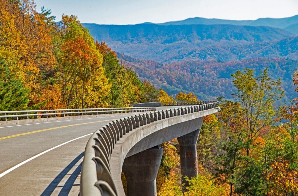
Let’s talk about the trending topic of the Missing Link, even though it was completed in 2018. Not only was it delayed time and time again, but it also provides one of the most famous nail-biting stretches of the Foothills Parkway.
The Missing Link centers around section 8E, Wears Valley to Carr Creek. The bulk of the 1980s saw construction focused on this 9.7-mile section, but a 1.65-mile portion faced landslides, environmental issues, and ongoing delays. That challenging section was known as the Missing Link.
The solution was a series of bridges, not cheap or easy, that ended up taking until 2018 to complete the Missing Link of the Foothills Parkway.
 Foothills Parkway | photo via Shutterstock / Betty Shelton
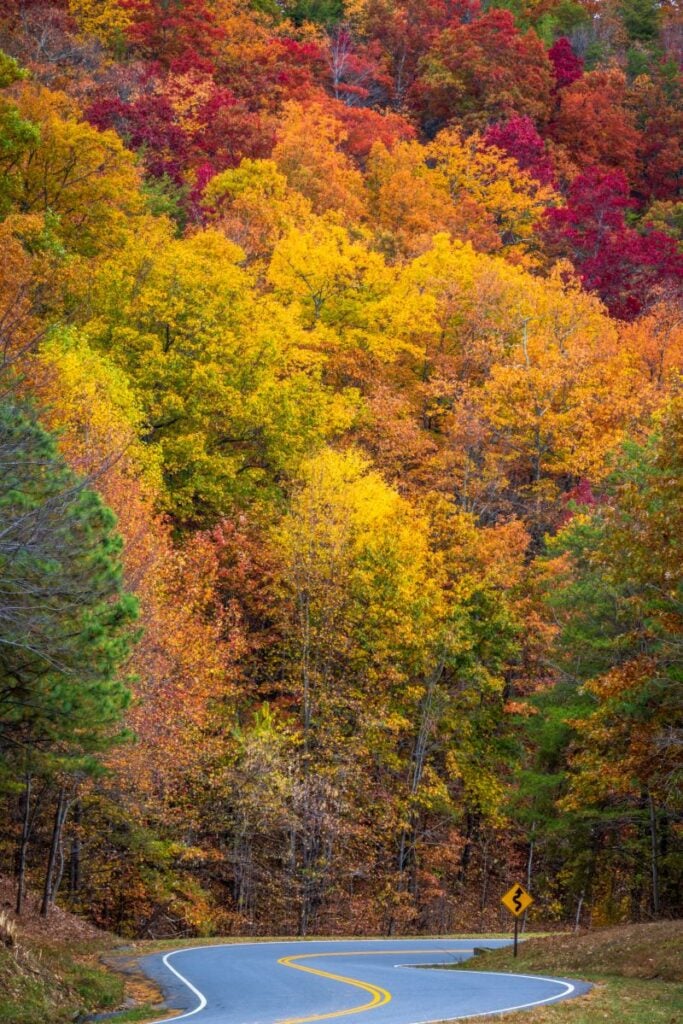 Wears Valley | photo via Shutterstock / Weidman Photography
 Foothills Parkway | photo via Shutterstock / Wildnerdpix
 Foothills Parkway | photo via Shutterstock / ISnapped
Foothills Parkway Access Points
Due to the extensive right-of-way and environmental protections of the federally approved parkway, access points are limited but reasonable along the route. Since most drivers will start near Gatlinburg, that’s where we’ll start the drive-through details as well.
As a reminder, no fuel, food, or services are found on the Foothills Parkway.
Wears Valley to Walland
On the Peaceful Side of the Smokies, Wears Valley and Townsend are worth exploring on their own, but this is the easiest access point to the Foothills Parkway from Gatlinburg or Pigeon Forge. Drive about eight miles on Wears Valley Road until you reach the entrance to the Parkway.
NOTE: Don’t expect big flashing signs alerting you to this amazing scenic drive. The signs are simple but clear, about 500 feet from the entrance.
At this point, forget about the 8E type naming convention. While 8E goes to Carr Creek, there is no exit at Carr Creek. The first exit from Wears Valley sits 15 miles away in Walland. This stretch of the Foothills Parkway is a detour off of U.S. Route 321, passing the traffic of Wears Valley and Townsend.
This route includes the Missing Link, with 10 bridges. For what it’s worth, I’m about an 8 out of 10 when it comes to a fear of heights, and I was only a little nervous on the longest stretch of bridges. However, some reviews show people felt it was slightly harrowing.
Walland to Murray Gap
Along the next 10 miles of the Foothills Parkway past Walland, the views start to amplify as you head to the high point of the scenic drive. This section includes a growing number of parking areas and overlooks, but they are not one and the same.
Overlooks include parking but are specifically chosen for outstanding views. Parking areas might include great views but are more practical than pretty. When in doubt, stop at an overlook.
Probably the most important stop anyone driving the Foothills Parkway will make is at Flats Road (“The Flats”), which offers several amazing things to see and do.
Look Rock is the highest point on the Foothills Parkway at 2,652’. The lower overlook offers a viewing platform below the parking area. A half-mile trail leads 200 feet up to an observation tower much like Kuwohi (formerly known as Clingmans Dome) but a lot less crowded. Finally, Look Rock Picnic Area is a more expansive, relaxed area where you can enjoy the views.
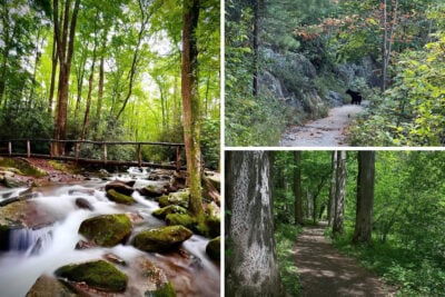
One of the least crowded entrances to Great Smoky Mountains National Park is accessed through The Flats, which is ideal for those who like solitude and wilderness. Visit the Abrams Creek Ranger Station for trail information, with options like Abrams Falls Trail without the crowds from Cades Cove.
Murray Gap to Chilhowee
The final seven or so miles wrap up the western edge of Foothills Parkway. You’ll get one more overlook before reaching U.S. Highway 129, known as the Tail of the Dragon. You can continue down that famous (infamous?) road or turn around and do the Foothills Parkway in the other direction.
I-40 to Crosby
The eastern edge of Foothills Parkway runs nearly six miles with four overlooks between I-40 and U.S. Route 321 (Cosby Highway) in Cosby. As you sit at that intersection, imagine the road continues on, as that’s where the 8B is slated to start.
A bonus of visiting the eastern edge of the Smokies is the connection to Cherokee National Forest and the whitewater rafting options along the Pigeon River, with several vendors in Hartford, Tennessee.
Plus, the Cosby entrance of Great Smoky Mountains National Park leads to some of the highest peaks in the range.
While some estimates say the Foothills Parkway completion is about 20 years away, there’s no way to know for certain since economic conditions largely impact if funding will be available. Plus, the remaining 33-mile stretch is one of the most geographically challenging for construction.
In simpler terms, don’t wait to visit the Smokies until the Foothills Parkway is finished. It’s gonna be a while!
The Politics of Foothills Parkway
A fascinating part of the Foothills Parkway development comes from the more popular Blue Ridge Parkway, connecting Great Smoky Mountains National Park and Shenandoah National Park in Virginia.
Initially, the Blue Ridge Parkway would go through Virginia, North Carolina, and Tennessee, but when North Carolina leaders realized the route would bypass the tourism town of Asheville, they ramped up their efforts.
Tennessee ended up left out of the Blue Ridge Parkway footprint, a wound that still hasn’t healed for many old-timers here. That ire fueled the proposal for a Tennessee-only parkway showcasing the Great Smoky Mountains.
I doubt Tennesseans would let the parkway go into North Carolina, anyway, even for all the moonshine in those secret tunnels under the park.
Top 3 Things to Know About Driving Foothills Parkway
Based on our own experiences and questions from our readers, here are the top three things to keep in mind when planning a trip on the Foothills Parkway of Great Smoky Mountains National Park.
- Check Road Conditions: Every entrance to Foothills Parkway has a set of gates that will close it down due to storm damage, winter weather, or other public safety concerns. Since the road is managed by Great Smoky Mountains National Park, you can find closure information on the park’s website. Since you’ll connect to Tennessee roads, use TN 511 for traffic information.
- Free to Drive: Foothills Parkway is free to drive, with no admission, just like Great Smoky Mountains National Park. However, a parking tag is required for anyone planning to park for more than 15 minutes. A parking tag kiosk is on the Foothills Parkway West only at Look Rock Campground.
- Road Etiquette: Since Foothills Parkway is a two-lane road, you’ll likely run into drivers or motorcyclists trying to go faster. Simply pull over at the next parking area to let people pass if you’re holding up traffic, even if you are going the speed limit. Don’t let that stress ruin the experience.
Expect motorcycles on this road, especially as you get closer to the Tail of the Dragon, which is the apex of biking roads. Always look twice before passing. Keep an eye out for bicyclists as well. Without a bike lane, you’ll need to share the road.

The Best Time to Drive Foothills Parkway
A fall foliage drive on Foothills Parkway is pure heaven. Visit anytime during October to see some iteration of the palette changing.
Above 4,000 feet develops first, in the early part of the month through mid-October. Then lower elevations catch up in mid to late October. The trails of the west side of Foothills Parkway will be far less crowded in the busiest month at Great Smoky Mountain National Park.
April brings bursts of wildflowers throughout the month, with the annual Wildflower Pilgrimage in the last week. During this time, stop at as many overlooks as possible to see what’s blooming.
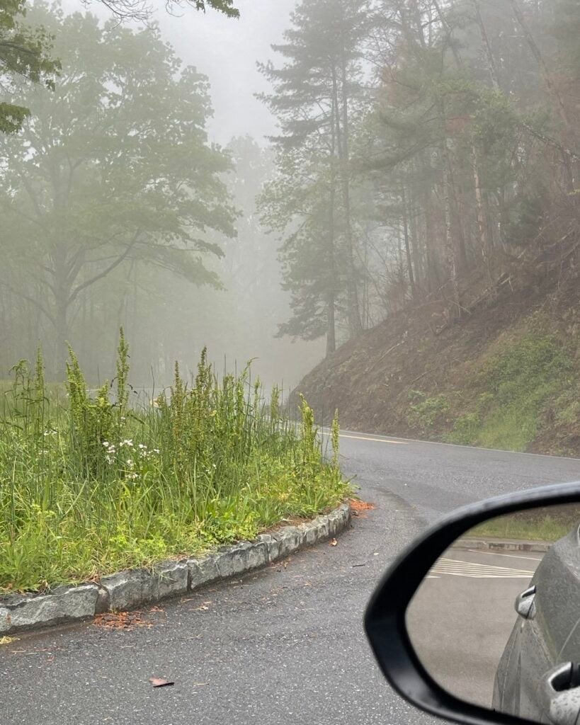
Barring winter weather, don’t dismiss Foothills Parkway from December through March. One benefit is the lack of leaves and greenery means better views at every turn.
In the event snow or ice accumulates, roads will only be treated on sections that are main thoroughfares to towns – much like Newfound Gap is plowed, but Kuwohi is not.
Plus, with all those curves and bridges (which freeze over first), Foothills Parkway poses safety risks during winter storms. Even high wind warnings will likely close down the road.

Find Your Way to Foothills Parkway
Whether you want a break from the crowds, a romantic adventure, or a backcountry trek, Foothills Parkway leads to the path less traveled. Enjoy the incomplete path while you can because once it connects to Gatlinburg, more traffic will spill onto this scenic stretch.
Also, 12 of the overlooks on Foothills Parkway are approved wedding locations by Great Smoky Mountains National Park.
No matter what the circumstances are, if someone asks if you want to drive the Foothills Parkway, say, “I do!”