A Local’s Guide to the Smoky Mountains Middle Prong Trail
Would you like to save this full guide?
One of the major reasons why people come to the Smoky Mountains is to hike on the many trails that suit everyone from the casual walker to the hardcore outdoors enthusiast.
When you’re on some of these hiking trails in Great Smoky Mountains National Park, you can enjoy the thrill of the sound and power of Smoky Mountain waterfalls. That’s exactly what you’ll get when hiking Middle Prong Trail.

The Middle Prong Trail is an 8.2-mile, round-trip hike that follows the Lynn Camp Prong, a creek that winds past a series of cascades that photographers love. One hiking site even calls this trail the “best waterfall hike” in the area.
Note: While the full hike is 8.5-miles long, there are many waterfalls and scenic views along the trail that don’t require hikers to traverse the full distance.

Middle Prong Trail in the Tennessee Smoky Mountains
Middle Prong Trail, just outside Townsend Tennessee, is one of the most beautiful hiking trails in the Smoky Mountains and gets its fair share of hikers. Some would describe it to be a somewhat challenging hike, but once you’ve started on it, you’ll understand why it’s such a popular trail for hiking enthusiasts in the Tennessee Smoky Mountains.
While taking this beautiful hike through the Smoky Mountains, you’ll enjoy wildflowers, waterfalls, and even a little bit of history for good measure.
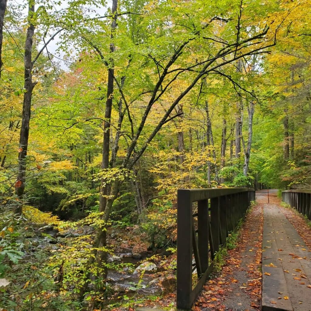
Another bonus about the Middle Prong Trail is its width, at least for the first part. Once a railroad bed for the Little River Lumber Company during its logging days, the wide trail affords plenty of space for hikers coming and going.

How to Get to the Middle Prong Trailhead
The Middle Prong Trailhead is located just a short distance from the Tremont Institute in Great Smoky Mountains National Park. Coming from Gatlinburg and the Sugarlands Visitor Center, turn right along Little River Gorge Rd toward Cades Cove.
Continue driving for 17.5 miles, passing Elkmont, Metcalf Bottoms, and the “Y” at Townsend (State Hwy 73 and Little River Rd). Right after the “Y” (0.2-miles), turn left on Tremont Rd.
Next, drive 2.1 miles on Tremont Rd until you reach the Great Smoky Mountains Institute at Tremont. At that point, the paved road turns into a gravel road (Upper Tremont Rd) for the next 3.1 miles. There are numerous potholes and several single-car bridges.
During the winter months, Upper Tremont Rd may be temporarily closed because of weather.
The road comes to an end at the trailhead for the Middle Prong Trail, where a parking lot is located alongside a metal bridge.
Note: Be aware that this trailhead parking area gets crowded on weekends and holidays, so plan your arrival accordingly.
The Former Community of Tremont
The Middle Prong Trailhead starts at the confluence of the Lynn Camp Prong and Thunderhead Prong, giving the Middle Prong its name. When you cross the footbridge here, you’ll notice the remnants of a small logging town — Tremont.
Tremont is a combination of the terms “tree” and “mountain.” Ironically, in the early 1900s, the Little River Railroad and Lumber Company, located in Townsend, harvested most of the trees in this region, leaving the area with very few trees.
Despite the establishment of the national park, the lumber industry continued to operate in the area because of agreements with private landowners. Although it appears to be a gravel road, the trail is actually an abandoned railroad bed from the logging railroad that served the town until logging operations stopped in the late 1930s.

Smoky Mountain Waterfalls & Primitive Sites Along the Middle Prong Trail
As you approach the river from the trailhead, you’ll cross a footbridge. Equestrian riders must dismount and lead their horses across the bridge by hand.
The roar of falling water and crossing of the river transport you to another world of dense, lush vegetation, flowing water, and a broad route. Middle Prong Trail has a rough dirt surface with gravel on top. The trail is mostly flat, but the occasional exposed root or rock can be a challenge.
The route divides immediately after crossing the trailhead footbridge. Some hikers may be confused by the trail signs because it doesn’t specify which path to use. We recommend keeping to the left, following the trail along the river.
Note: While many hiking guides consider this to be a moderate to strenuous hike, we feel it falls into the “easy hike” category and would be appropriate for hiking with kids in the Smoky Mountains (the length of the hike and the slight incline are probably the biggest factors in determining its difficulty).
Things to See Along the Middle Prong Trail
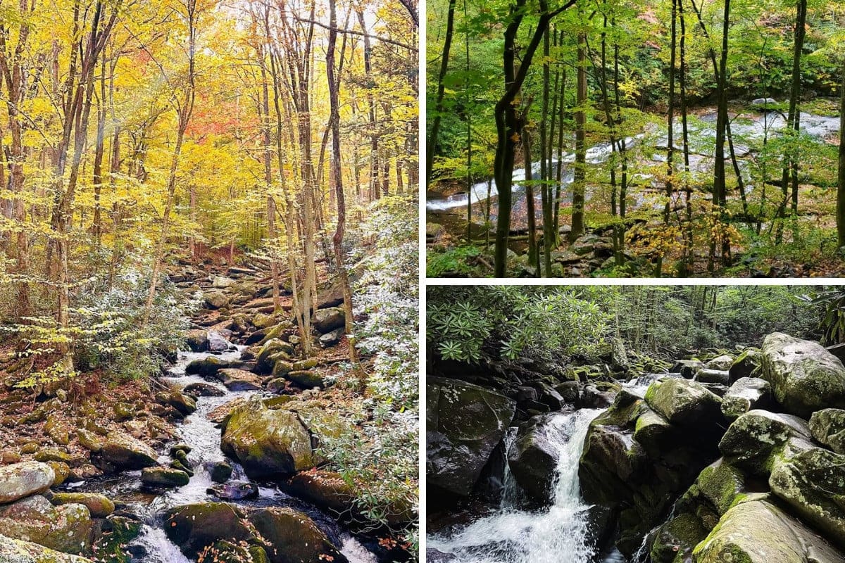
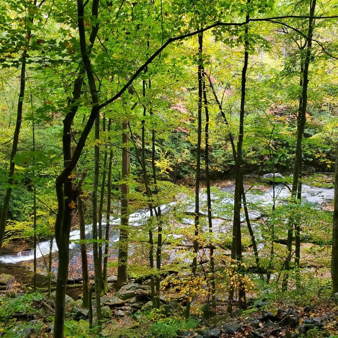
The main highlight of the Middle Prong Trail is the beautiful water. The entire length of the trail shadows the river. From beginning to end, you’ll see and hear the rushing river, magnificent waterfalls, and picturesque cascades.
During springtime along this trail, you’ll see a showcase of wildflowers, including trilliums, violets, irises, and others.
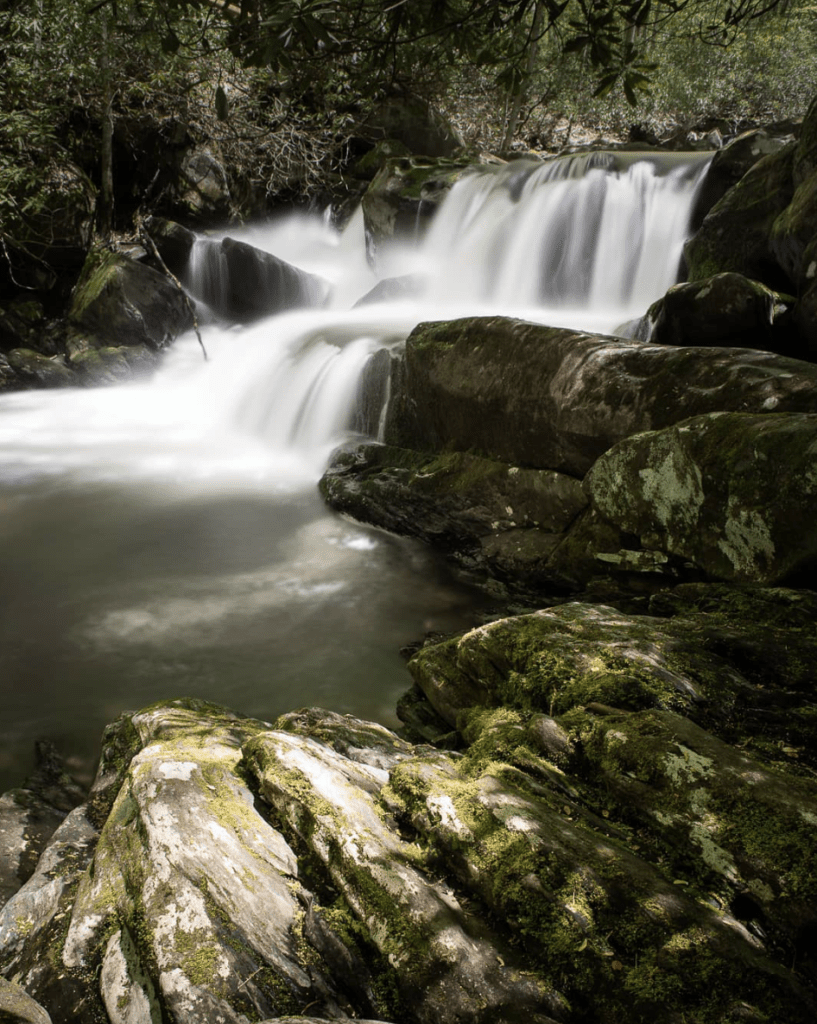
Lynn Camp Falls
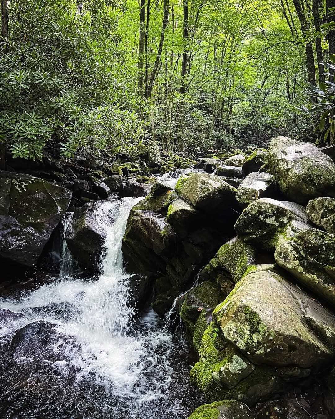
In a little under half a mile from the trailhead, you’ll come to the Lynn Camp Prong Cascades, sometimes referred to as Panther Falls. This multi-tiered 35-foot waterfall is one of GSMNP’s more stunning waterfalls, especially during the rainier months of the year.
Depending on the season, the cascades will either come in a powerful rush or a calming flow. But they’re impressive falls no matter how much water runs through.
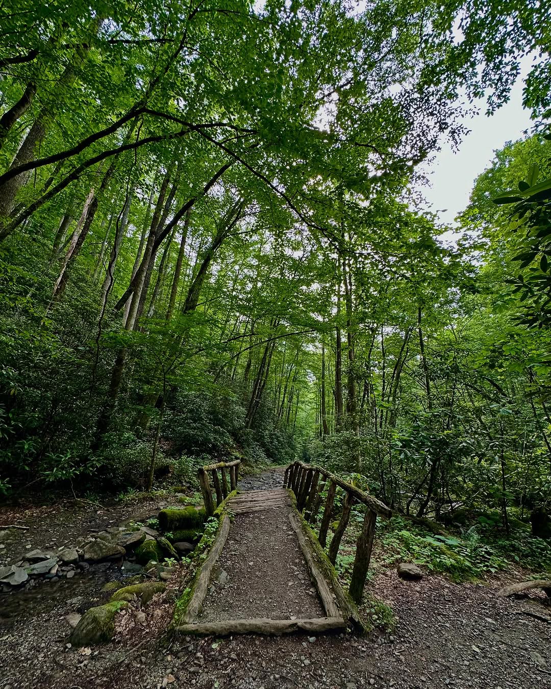
At two-thirds of a mile from the trailhead, you’ll encounter Lynn Camp Falls, another picturesque multi-tiered cascade. Then about 1.5 miles into your hike, you’ll cross a small footbridge over a small contributary stream. Watch your step over the rocks on either side of the footbridge!
Tremont & Middle Prong Civilian Conservation Corps
If you’re looking for history along the trail, don’t miss the rusted shell of a 1920s Cadillac or Packard around the 2-mile mark of the trail — evidence of the old Tremont community.
Though hidden from view along the main trail, you can take the spur trail to the right. You’ll find it just before reaching the Panther Creek Trail intersection. Past hikers have left a pile of rocks in the middle of the main trail to help indicate the unmarked trail’s location.
And just a bit further, around 3.1-miles in, you can see parts of a chimney and an old railroad track, marking the former camp location of the 1461 Company of the Middle Prong Civilian Conservation Corps. The chimney was once part of the dining hall that fed 172 men.
Indian Flats Falls
At about 3.7 miles, you’ll pass a footbridge over Indian Flats Prong. Just before that, there are two smaller streams to cross without the convenience of a footbridge. If it’s been raining a lot, you might want to bring trekking poles to keep your balance when rock-hopping across these two streams.
Just after the footbridge, you’ll come across an unmarked side path that forks off to the right, slightly over 4 miles from the trailhead. This route goes to Indian Flats Falls, near the end of the Middle Prong Trail.
At the End of the Middle Prong Trail
Middle Prong Trail comes to an end at 4.1 miles, when it meets Greenbrier Ridge Trail. At this point, you can either turn back toward the trailhead, or you can keep hiking. You’ll reach the Appalachian Trail if you continue trekking the Greenbrier Ridge Trail for another 4.2 miles.